A Gazetteeer of the World, or, Dictionary of geographical knowledge ... Edited by a member of the Royal Geographical Society. Illustrated with ... woodcuts and one hundred and twenty engravings on steel
1856|A. Fullarton
Carte de l'archipel de Riouw, Singapore et Linga
1849|Melvill van Carnbée, P. , Baron
Figurative kaart van een gedeelte van Sumatra voornamelijk aantoonende de wegen en rivieren, welke uit de Padangsche binnenlanden naar de oostkust afloopen
1837|opgenomen door S. Muller en H. Hellbach1:1 360 000
"Figurative kaart der Nederlandsche bezittingen op Sumatra."
1800
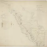
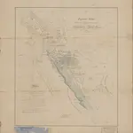
Figuratieve schets van het Gouvernement Sumatra's Westkust tot 1830 / door H. de S.
1830
To Captain Samuel Ashmore, in acknowledgement of much valuable information given, elucidative of oriental navigation, and of the western coast of Sumatra in particular
1832|this chart is inscribed by James Horsburgh1:1 800 000
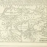 1856|A. Fullarton
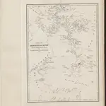 1849|Melvill van Carnbée, P. , Baron
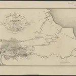 1837|opgenomen door S. Muller en H. Hellbach1:1 360 000
 1800
1800
 1830
1830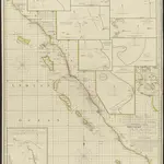 1832|this chart is inscribed by James Horsburgh1:1 800 000
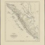 1855|te 's Hage : uitgave van K. Fuhri