地图 普拉克明兹堂区
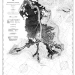 Nautical Chart of Mississippi River1874|C&GS1:80 000c
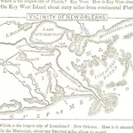 Cornell's Intermediate Geography: forming part second of a systematic series of school geographies, etc1857|CORNELL, Sarah S.b
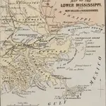 Prang's Naval Expedition Maps: the Lower Mississippi, New Oreans, and vicinity1862|L. Prang & Co.b
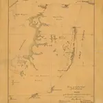 Sketch of the Chandeleur and the Isle Au Brelon Sound From A General Reconnaissance of May and June 18521852|Unknown1:127 543c
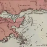 Lloyd's Military Campaign Charts: New Orleans - Mouth of Mississippi1861b
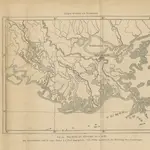 Neue Probleme der vergleichenden Erdkunde als Versuch einer Morphologie der Erdoberfläche, etc1870|PESCHEL, Oscar Ferdinand.b
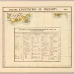 Embouchure du Mississipi. Amer. Sep. 61.1827|Vandermaelen, Philippe, 1795-18691:1 641 836d
1600
1650
1700
1750
1800
1850
1900
1950
2000
普拉克明兹堂区的老地图
在历史地图上发现 普拉克明兹堂区 的过去
普拉克明兹堂区的老地图
在历史地图上发现 普拉克明兹堂区 的过去
寻找 谷歌地图应用程序接口替代方案?