项目
社区
新闻
我的应用程序
我的地图
地图 大马士革
高级搜索
全部
私人
收藏夹
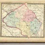
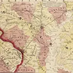
Montgomery.
1866|Martenet, Simon J.
1:221 760
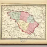
Howard.
1866|Martenet, Simon J.
1:221 760
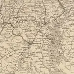
Topographical atlas of Maryland: counties of Carroll and Frederick.
1873|Walling, H. F.
1:221 760
Map of the Battle Ground, showing 5 mile distances from Washington
1861|L. Prang & Co.
Map of the Seat of War: Washington, Baltimore, Harper's Ferry and Annapolis
1861|L. Prang & Co.
Bird's eye view of part of Maryland, Distr of Columbia and part of Virginia
1861|Bachmann, John
Strategic War Points of the United States no.1: Country Road Washington
1861|J. Wyld
1600
1650
1700
1750
1800
1850
1900
1950
2000
历史
大马士革的老地图
在历史地图上发现 大马士革 的过去
大马士革的老地图
在历史地图上发现 大马士革 的过去
探索地图
发现历史
母区域
叙利亚
相关地点
© MapTiler
© OpenStreetMap
 1866|Martenet, Simon J.1:221 760
 1866|Martenet, Simon J.1:221 760
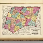 1873|Walling, H. F.1:221 760
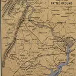 1861|L. Prang & Co.
 1861|L. Prang & Co.
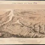 1861|Bachmann, John
 1861|J. Wyld