Project
Gemeenschap
Nieuws
Mijn app
Mijn kaarten
Kaarten van Chilliwack (Brits-Columbia)
Geavanceerd zoeken
Alle
Privé
Favorieten
Sheet No. 7. (Title Sheet) Photo-Lithographic Copy Of The Detailed Maps Of The North West Boundary.
1866|Campbell, Archibald
1:60 000
Washington Territory Lying West of the Rocky Mountains,1858
1858|U.S. General Land Office
1:1 140 480
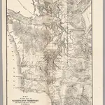
Map of Public Surveys, Washington Territory, 1863
1863|U.S. General Land Office
The North-West Coast; or, three years' residence in Washington Territory. ... With ... illustrations
1857|SWAN, James Gilchrist.
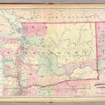
Washington.
1874|Asher & Adams
1:1 267 200
Map of the Gold Regions of the Frazer River and the Washington Territory on the Western Coast of America. By J. Wyld
1858|London
Map of Public Surveys in the Territory of Washington,1862
1862|U.S. General Land Office
1600
1650
1700
1750
1800
1850
1900
1950
2000
Geschiedenis
Oude kaarten van Chilliwack (Brits-Columbia)
Ontdek het verleden van Chilliwack (Brits-Columbia) op historische kaarten
Oude kaarten van Chilliwack (Brits-Columbia)
Ontdek het verleden van Chilliwack (Brits-Columbia) op historische kaarten
Ontdek kaarten
Ontdek geschiedenis
Ouderlijke regio
Brits-Columbia
Verwante plaatsen
© MapTiler
© OpenStreetMap
 1866|Campbell, Archibald1:60 000
 1858|U.S. General Land Office1:1 140 480
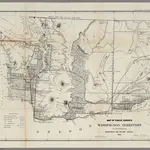 1863|U.S. General Land Office
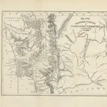 1857|SWAN, James Gilchrist.
 1874|Asher & Adams1:1 267 200
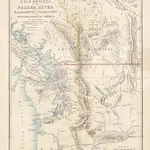 1858|London
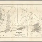 1862|U.S. General Land Office