Projet
Communauté
Actualités
Mon appli
Mes cartes
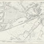
Kent VIII.8 (includes: Bexley; Chislehurst and Sidcup) - 25 Inch Map
1937
Ordnance Survey
1:3k
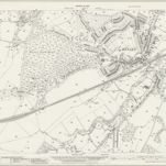
Kent VIII.8 (includes: Bexley; Chislehurst and Sidcup) - 25 Inch Map
1930
Ordnance Survey
1:3k
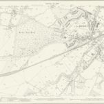
Kent VIII.8 (includes: Bexley; Chislehurst and Sidcup) - 25 Inch Map
1908
Ordnance Survey
1:3k
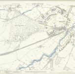
Kent VIII.8 (includes: Bexley; Chislehurst and Sidcup) - 25 Inch Map
1895
Ordnance Survey
1:3k
RAF Aerial Collection (1945 - 1949)
1947
RAF
1:5k
RAF Aerial Collection (1945 - 1949)
1947
RAF
1:5k
RAF Aerial Collection (1945 - 1949)
1947
RAF
1:5k
RAF Aerial Collection (1945 - 1949)
1947
RAF
1:5k
RAF Aerial Collection (1945 - 1949)
1947
RAF
1:5k
RAF Aerial Collection (1945 - 1949)
1947
RAF
1:5k
L'histoire
Anciennes cartes de Bexley (Londres)
Découvrez le passé de Bexley (Londres) sur des cartes historiques
Anciennes cartes de Bexley (Londres)
Découvrez le passé de Bexley (Londres) sur des cartes historiques
Explorer les cartes
Découvrir l'histoire
Région parente
Angleterre
Lieux apparentés