Project
Community
News
My App
My maps
Maps of Nový Dvůr (Nymburk District)
Advanced search
All
Private
Favorites
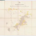
Generalkarte der Hugo Fürst von Thurn Taxis'schen Waldungen
1860
1:21 000
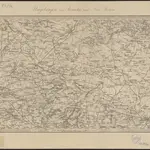
Umgebungen von Brandeis und Neu Kolin
1869|K.K. Militaerischen Geographischen Institute
II. vojenské mapování 14
1871
1:144 000
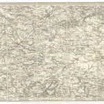
Umgebungen von Brandeis und Neu Kolin
1871
1:144 000
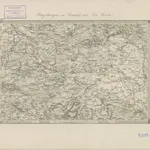
Umgebung v. Kauržim
1830|Marco Berra
Prag
1800|Fils
1:200 000
Generalkarte der Fürst Hugo Thurn Taxis'schen Waldungen
1865|Schmidt, Josef
1:19 500
1600
1650
1700
1750
1800
1850
1900
1950
2000
History
Old maps of Nový Dvůr (Nymburk District)
Discover the past of Nový Dvůr (Nymburk District) on historical maps
Old maps of Nový Dvůr (Nymburk District)
Discover the past of Nový Dvůr (Nymburk District) on historical maps
Explore Maps
Discover History
Parent places
Nymburk District
Related places
© MapTiler
© OpenStreetMap
 18601:21 000
 1869|K.K. Militaerischen Geographischen Institute
 18711:144 000
 18711:144 000
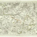 1830|Marco Berra
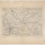 1800|Fils1:200 000
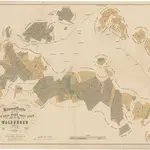 1865|Schmidt, Josef1:19 500