Project
Community
News
My App
My maps
Maps of Maillet, Indre
Advanced search
All
Private
Favorites
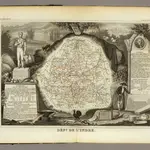
Dept. De L'Indre.
1856|Levasseur, Victor.
1:580 000
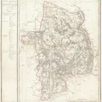
Département du Cher
1810|P. G. Chanlaire et Dumez
1:265 000
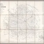
Carte du Département de l'Indre / Ad. Appé et E. Robin del.
1862|Appé, Ad.; Robin, E.
1:200 000
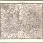
Limoges
1838|Weiss, J.H.
1:500 000
V.1:1-5: I: Frankreich. DEP: 45. Der Indre. 46. Der Creuse. 48. Der Vienne
1825|Hermann, O.
1:400 000
V.1:1-5: I: Frankreich. DEP: 38. Der Indre und Loire. 39. Des Loire und Cher. 44. Des Cher
1825|Hermann, O.
1:400 000
Dept. De Cher.
1856|Levasseur, Victor.
1:563 000
1600
1650
1700
1750
1800
1850
1900
1950
2000
History
Old maps of Maillet, Indre
Discover the past of Maillet, Indre on historical maps
Old maps of Maillet, Indre
Discover the past of Maillet, Indre on historical maps
Explore Maps
Discover History
Parent places
Arrondissement of La Châtre
Related places
© MapTiler
© OpenStreetMap
 1856|Levasseur, Victor.1:580 000
 1810|P. G. Chanlaire et Dumez1:265 000
 1862|Appé, Ad.; Robin, E.1:200 000
 1838|Weiss, J.H.1:500 000
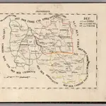 1825|Hermann, O.1:400 000
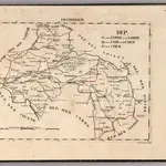 1825|Hermann, O.1:400 000
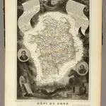 1856|Levasseur, Victor.1:563 000